Azores Islands
Developed by Flytomap | Last updated: May 19, 2024

Azores Islands - GPS Map Navigator is a navigation app, developed by Flytomap, available on iOS and Android since its release in December 2009. The updated version 3.5.5 is now available to download, compatible with iOS 9.0+ and Android 10+. Before downloading this app, let's quickly review what Azores Islands GPS Map Navigator has to offer.
About Azores Islands
Flytomap is a valid and interesting alternative, Benetti Yachts
Top Ten 2011,2012,2013,2014,2015 & 2016
Featured in : On the Deck
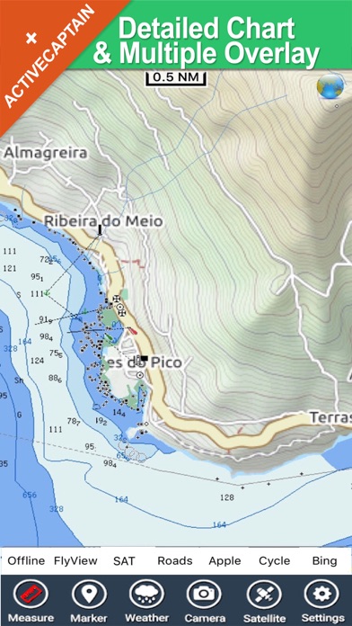
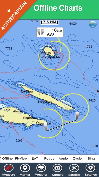
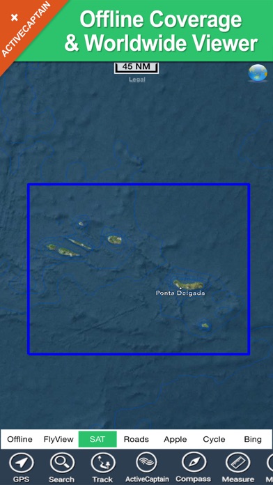
Azores Islands coverage resident in the app. It works WITHOUT mobile coverage!
Worldwide Marine and Outdoor Maps available when connected, thanks to viewer.flytomap.com
Worldwide Satellite images overlay on charts
Worldwide Terrain features overlay on charts, thanks to Open Street Map, Open Cycle Map, Bing,Earth,GMap
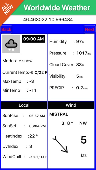
Worldwide Weather forecast
Join ActiveCaptain - Worldwide boaters community * 100.000 + Captains
Use to Explore:
√ Latitudes and Longitudes to go to your favorite places
√ Search your Favorite points directly
√ Zoom, Rotate and Pan fast just by a finger touch
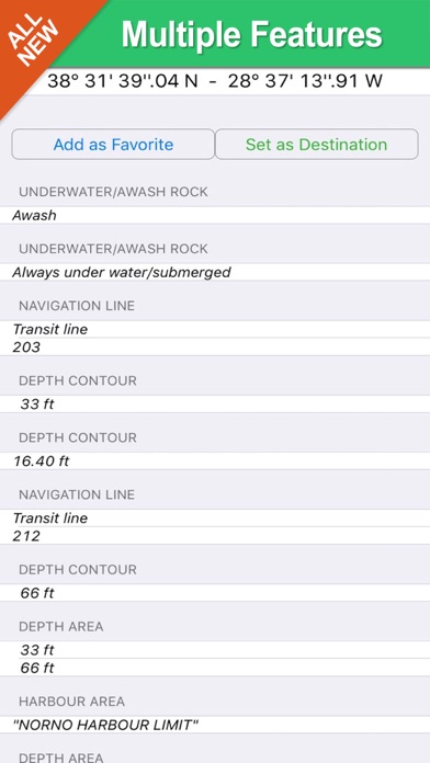
√ Quick Object information just tapping, thanks to vector technology
√ GPS Heading Vector Towards the direction movement
√ Distance Measurement Tool to easily calculate the distance from one location to another
√ Route planning, Waypoints - Insert the target/destination and see in real time your speed, distance and bearing
√ Magnified Lens for all info
√ Unlimited Tracks, Markers, Geo-tagged photos, records and share via email, visible on Google, Flytomap Viewer, KMZ format - Store your track without the need of cellular data or mobile signal
√ Select Depth Contours
√ a la carte menu
√ MOB - Man Over Board
√ Quick WP - allows you to instantly record your position and show distance and bearing
√ iOS background mode - Flytomap works in background as well, you can swap with another app and receive/make calls send sms while track recording.
√ Optimized battery usage
√ ActiveCaptain
• View and contribute to the best boaters community available in the world
• Continuous update of all info (including reviews from the deck) about :
• Marinas
• Anchorages
• Hazards
• Local Knowledge
√ Worldwide Marine Weather forecast at a quick tap provide you:
• Day max and min temperature - Current temperature
• Significant wave height, Swell height, Swell period, Swell direction
• Tide data
• Sea temperature
• Wind Speed and direction
• Weather description
• Precipitation & Humidity
• Visibility
• Pressure
• Cloud cover in percentage
• Wind chill/Feels like Temperature
• Water Temperature
• Dew Point Temperature
• Heat Index Temperature
√ And so much more to come - It’s the only app you will ever need! Our charts are installed on: GARMIN NAVICO LOWRANCE B&G NORTHSTAR EAGLE SIMRAD
Follow us:
▶Twitter @flytomap
▶Web Site flytomap.com
▶Web App viewer.flytomap.com
▶Facebook facebook.com/flytomap
Flytomap is committed to constant improvement, this App is developed with the help of professional boaters to get the best experience on the sea, we listen to our users and systematically add the most requested features.
Thank you for the feedback!
"Continued use of GPS running in the background can dramatically decrease battery life."
What's new in version 5.5
Track improvement
Marine Weather algorithm update
Download the Azores Islands App
Azores Islands has an IPA/APK download size of 20 MB on its latest version. Azores Islands costs $5.99 to download. Ready to install? Ensure you have at least 23 MB of storage space available, then tap the button or scan the QR code below to start the download process!
Ranking History in App Store (U.S)
Changelog
Compatibility
- Old devices: iPhone X/SE/8/7/6
- iPad Pro
- iPad Mini

Azores Islands has 0 reviews across all iTunes Stores.